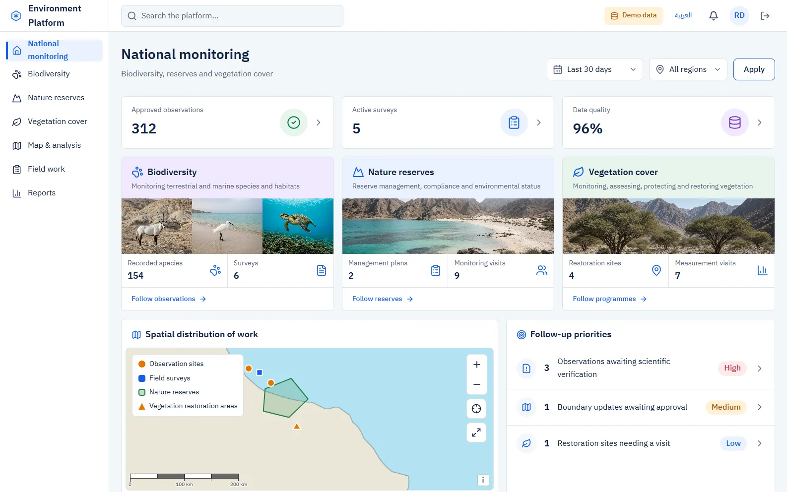
Biodiversity, protected areas and vegetation cover in one trusted system.
One national platform that moves environmental monitoring from scattered records to a single trusted source — with GIS as the system of record, rangers collecting data offline, and every record reviewed by a scientist before it counts.
Environmental data lived in separate databases, spreadsheets and paper. Reports were calculated by hand, maps were pictures rather than data, and field teams had no reliable way to collect data where there is no coverage.
Fragmented databases→ One governed platform
Paper in the field→ Offline mobile app with sync
Reports by hand→ Governed indicator formulas
Maps as pictures→ GIS layers as the source of truth
02 · One platform
Three tracks, one national view
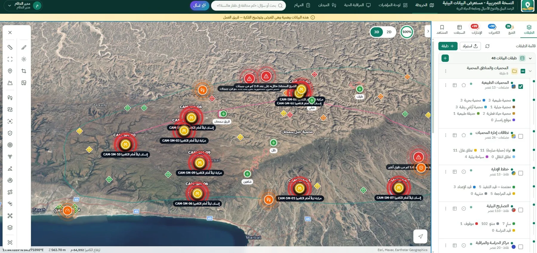
Biodiversity, protected areas and vegetation cover share one identity, one data-governance layer and one map — with a configurable workspace for every department. When the organisation changes, departments, forms and workflows are reconfigured, not rebuilt.
03 · Every source, one pipeline
Data comes in from everywhere — and is checked before it counts
Field surveys, camera traps, GPS collars, drones, IoT stations, satellite imagery and legacy files all enter the same governed pipeline.
1QuarantineMalware scan on every file
2ValidateSchema, coordinate system and geometry
3QualityRules and de-duplication
4ClassifySensitivity and ISO 19115 metadata
5ReviewScientific approval
6PublishMaps, reports and open data
04 · GIS as the system of record
Spatial science you can trust
Reserve boundaries, zones and observations are live, versioned layers — not pictures. Analyses run inside the platform, and every result carries its method card, version and validity verdict, so a map in a report can always be reproduced.
SummariseDensity, species richness, footprint screening
Every record moves Draft → Submitted → Reviewed → Approved → Published. It is reviewed by a different scientist, returned with notes when needed, and withdrawn with a reason — never deleted. Classification (public, internal, confidential, restricted) is inherited by every export, and sensitive species locations are shown only as 1, 5 or 10 km cells.
07 · Analytics & AI
“Ask the data” — with AI agents inside your organisation
Ask a question in Arabic or English and get a map, a chart and the sources behind them. Alerts explain themselves, and a 24-hour brief links every fact to its record. AI agents run on your own servers by default to protect your data; any external provider stays off unless you approve it, and then only for public data with names and coordinates masked.
Executive viewProgress to national targets on one screen
Monitoring & alertsThresholds, feed outages, geofenced SMS and push
Governed reportsIndicator catalogue, frozen runs with provenance
Questions people ask
Can field teams work without coverage?
Yes. The field app collects observations offline, including photos and locations, and syncs safely when the device is back online.
How is sensitive species data protected?
Records carry a classification that every export inherits, and sensitive locations are generalised to 1, 5 or 10 km cells for anyone without clearance.
Where does the AI run?
Inside your organisation, on your own servers, by default. External providers are disabled unless you approve them, and then only for public data with personal details and coordinates masked.